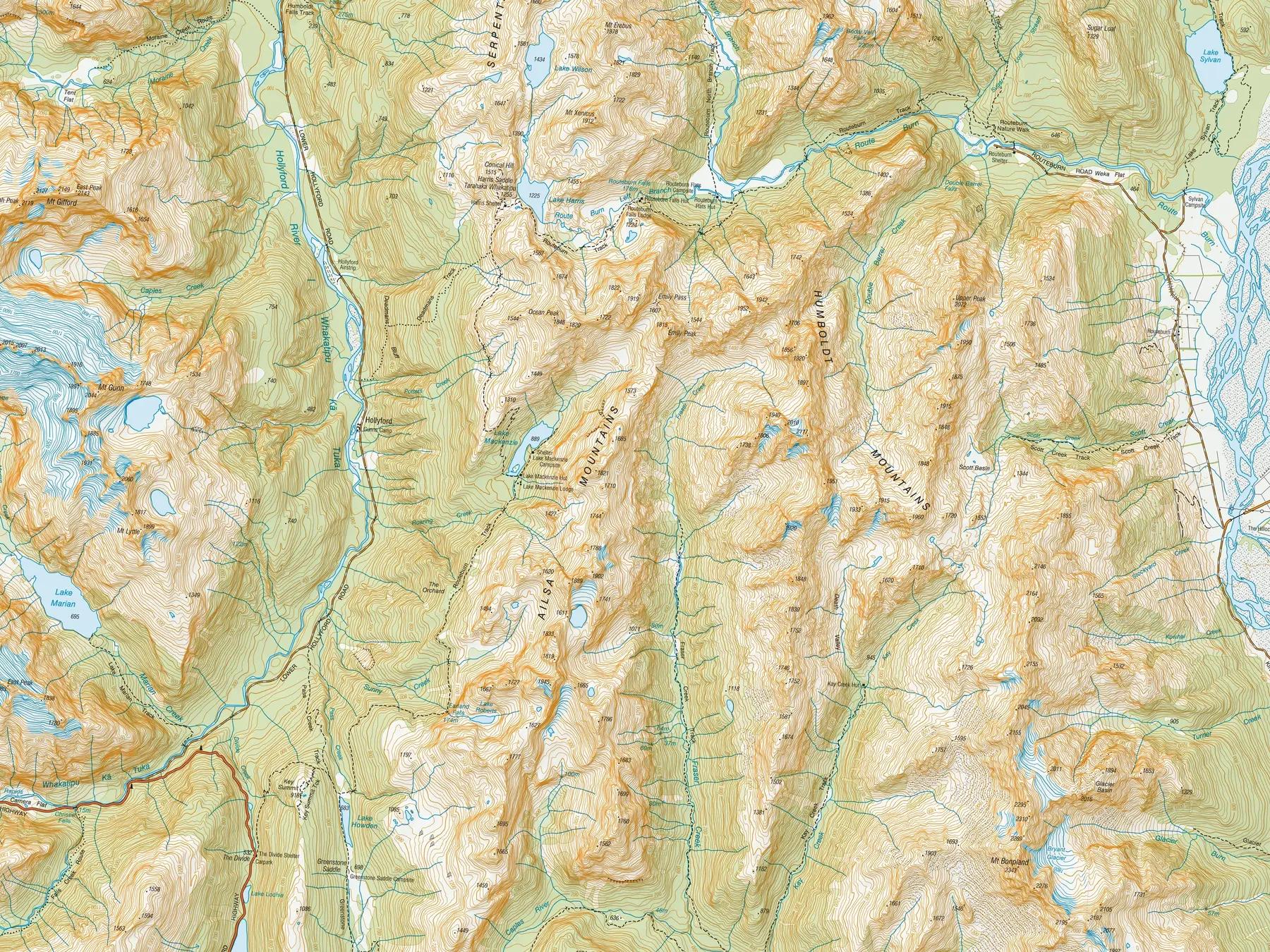
Every step, on the map.
On the web
New Zealand’s topo map with every DOC track, hut and campsite, your own tracks, and 3D fly-overs of every route.
On your iPhone
Logs your tramp in the background and keeps sending your position over satellite when there’s no cell coverage, so the people at home can follow along live.
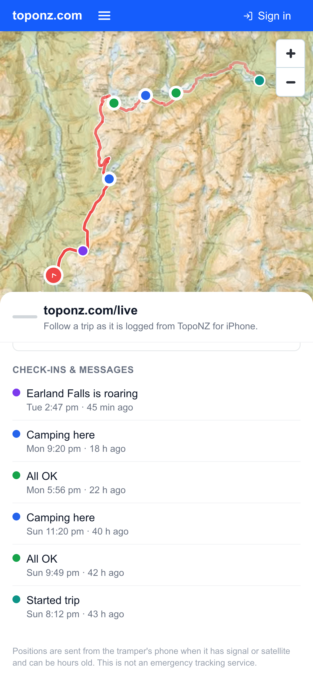
See where you are and where you’ve been.
Your trips sit on a detailed topo map. Zoom into a ridgeline, check a river crossing, or see the whole route at once.
Every DOC track, hut and campsite.
Department of Conservation tracks, huts and campsites are already on the map. Turn them on to plan a route, find the next hut, or see what’s near your track.
All of it, on one map.
Over 1,400 tracks, 900 huts and 300 campsites, the whole country, with the current DOC alerts. Search any of them by name or region and the map takes you there.
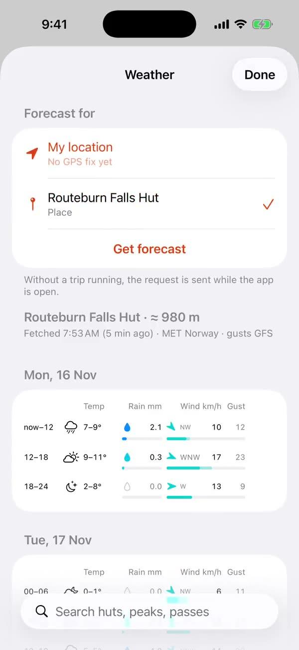
See the weather on your planned tramps.
Switch on Weather and the forecast plays under your saved tracks: ten days of rain, wind and pressure from NOAA’s GFS model, updated four times a day. Zoom out to watch a front cross the country, then back in to see what it brings to your route.
The weather where you’ll be, when you’ll be there.
Pick a start time on any saved track and see the forecast for each part of the route at the hour you’ll reach it: rain, wind and wind chill from the start, over the high point, to the end. Tick one box and TopoNZ for iPhone alerts you if the weather turns in the three days before you go, then sends a summary the evening before.
Your tracks, in one place.
Upload a GPX, draw a route, or log a trip from your phone. Every track sits in My Tracks with its own colour, ready to show, hide or share.
Distance, climb and every logged point.
Distance, time, height gained and your route, kept together for each trip. Open any track to see the full elevation profile and every logged point.
Relive the route from above.
Play any track as a fly-over across real terrain. Watch the climb, the saddle and the long walk out, in about a minute.
Log trips from your iPhone.
Start a trip.
One tap and the app starts logging.
Logs quietly in the background.
Light on battery and light on data.
Syncs when it can, even over satellite.
A clear indicator shows when your points reach the map, and the app alerts you if they haven’t for too long.
Check in.
Send an All OK check-in with your position, or a short message.
Let home follow along.
Share your Live ID and anyone can watch your trip on toponz.com/live: where you are now, each check-in as it arrives, and the climb so far.
How it works
Find the route on the map
DOC tracks, huts and campsites on the LINZ topo sheet.
Record it on your iPhone
Start a trip and put the phone away.
See every point on the map
Distance, climb and the elevation profile, saved as a track.
Replay it as a fly-over
Fly the track across real terrain.
Your next trip starts here.
